x



As global climate patterns shift into uncharted territory, humanity faces an urgent question: how do you prepare for a natural disaster that has never occurred before?
For decades, meteorologists, urban planners, and insurance actuaries have relied heavily on historical records to estimate climate risk. However, as global temperatures rise and trigger unprecedented atmospheric shifts, the past is no longer a reliable roadmap for the future.
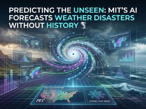
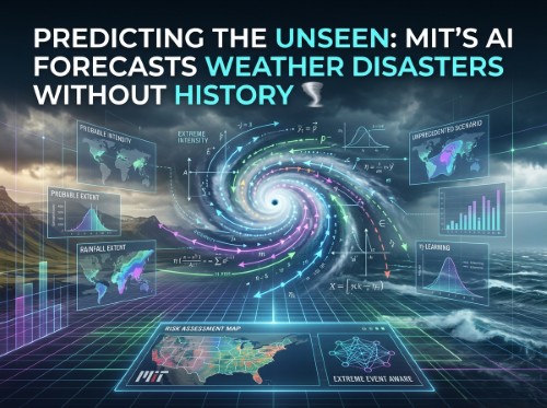
Recognising this dangerous blind spot, researchers at the Massachusetts Institute of Technology (MIT) have developed a groundbreaking artificial intelligence tool capable of forecasting extreme weather events without needing historical disaster data to learn from. Published in Nature Communications, this innovative methodology—termed Extreme Event Aware, or eta-learning—promises to transform how society builds resilience against catastrophic climate risks.
Traditional climate risk models operate under a fundamental constraint. To estimate the impact of a once-in-a-century storm or a record-shattering heatwave, conventional algorithms must first analyse previous instances of similar catastrophes. They evaluate the atmospheric conditions that created past disasters and project those historical patterns forward.
However, as MIT graduate student Kai Chang and Professor Themis Sapsis highlight, this approach limits our vision. If a specific region has never experienced a storm of a certain magnitude, standard models struggle to map out how that disaster might physically unfold across the landscape.
Professor Sapsis illustrates this limitation through the lens of historical hurricanes. A devastating event like Hurricane Katrina might occur once every 30 to 40 years. But planners urgently need to understand what a 100-year Katrina would look like, how far its storm surge would reach, and how severe its destruction would be. Relying purely on events that have already happened leaves communities vulnerable to black swan climate events that exceed all recorded memory.
The MIT team, affiliated with the MIT Centre for Computational Science and Engineering, solved this challenge by changing how AI interprets weather data. Instead of feeding the model vast libraries of past catastrophes, their eta-learning algorithm combines two distinct types of statistical information: point statistics and spatial mapping. Point statistics capture how frequently a particular level of intensity, such as maximum hourly rainfall, occurs across a broad regional dataset. Spatial maps detail how an event’s physical impact varies geographically across cities, terrain, and river basins.
By establishing the statistical bridge between these two data streams, the algorithm learns to project detailed spatial patterns for extreme events that lie completely outside its training history.
To demonstrate the model's capabilities, the researchers tested it on precipitation data across the continental United States. They calculated point statistics from 25 years of daily rainfall records. Crucially, however, the spatial model was trained on a tiny window of just six months of data—a period containing virtually no heavy or extreme rainfall events.
The algorithm successfully learnt how low-resolution weather patterns translated into high-resolution spatial details. It then applied the broader point statistics to constrain and generate physically plausible, high-intensity storm maps for events never previously observed in the record.
The practical applications of this technology are vast. Consider New York City, where the highest recorded daily rainfall stands at approximately 200 millimetres. Using eta-learning, engineers can generate detailed, highly accurate spatial maps of a hypothetical storm dropping 300 millimetres of rainfall over the city—an event with zero historical precedent.
A user can prompt the trained algorithm to show what a once-in-a-century storm might look like for a named city. The output provides a suite of statistically plausible storm maps, complete with estimates of duration, localised intensity, and geographical reach. Rather than guessing at potential impacts, infrastructure authorities can stress-test physical systems against concrete, statistically sound scenarios.
This capability unlocks critical insights across multiple sectors. In coastal protection, authorities can test whether proposed seawalls and levees can withstand unprecedented storm surges. For energy grid reliability, operators can simulate prolonged heatwaves or freezing rain events to ensure power networks do not collapse under sudden demand spikes. In wildfire management, teams can visualise the spread of blazes under extreme wind and drought combinations that have never been documented in local records. Additionally, supply chain operators can assess how severe localised disruption could ripple through global logistics and agricultural networks.
As Professor Sapsis points out, modern global infrastructure has been meticulously engineered for efficiency, often leaving little operational slack in the system. When a severe weather event hits, the shockwaves travel rapidly through food distribution, energy markets, and financial networks within weeks.
By assigning precise probabilities and detailed spatial footprints to events that have not yet occurred, eta-learning transforms climate adaptation from a reactive scramble into a proactive strategy. It equips governments, insurers, and engineers with the foresight required to reinforce critical infrastructure long before disaster strikes.
While applying the system to new hazards like severe wildfires or inland flooding requires tailored point and spatial data, the fundamental framework is already reshaping predictive climate science. In an era defined by climate instability, MIT’s AI breakthrough offers a vital tool for safeguarding humanity against the storms of tomorrow.
Disclaimer: This article is provided for informational purposes only, mistakes may be made, and it's not offered or intended to be used as legal, tax, investment, financial, or any other advice.